McKownville
Improvement Association
- McKownville houses and former occupants
- source data
There are three main sources for information on the houses
and past residents of McKownville:
A. Census enumerations (index files,
and notes - see below)
US Federal Census: 1940 (free access); 1930 1920 1910 1900 1880 (for 1930 and older, free with
account creation at FamilySearch.org
Most of the 1890 US
Federal census population schedules were badly damaged by a fire
in 1921
New York Census: 1925 1915 1905 1892 1875 (online free with
account creation at FamilySearch.org)
B. City directory listings (index
files, and notes
- see below)
Albany City Directories; (online through subscription to ancestry.com) up to 1956; and printed books
in some Public Libraries)
Guilderland-Colonie City Directories 1957- (printed books in the
Guilderland Public Library)
C. Deed indexes, deed documents, and lot maps (index files, and notes
- see below)
Deed books and indexes to the deed documents and lot maps can be
viewed at the Albany County Clerk's Office
For bound deed books prior to 1960, you have to visit the Albany County Hall of Records
Additional useful information may exist in old newspaper pages:
New York State Historic Newspapers website (includes the
Altamont Enterprise - Albany County holdings)
Census information on
past residents of McKownville
In the 1940 and 1930 censuses, the area on the north side of
Western Avenue was enumerated separately from the south side.
Earlier censuses covered all of McKownville, and beyond, with one
enumeration area (the 1925 census has been split here).
Edited index files for these census listings:
as ods (open document spreadsheet format) files; these files
contain multiple sheets, one for each of the census image pages.
1940n, 1940s, 1930n, 1930s, 1925n, 1925s 1920, 1915, 1910
The Association has pdf files of these page images which can be
viewed by residents on
request.
The same census information, but rearranged to be listed by
street, or street segment for Western Avenue:
as ods (open document spreadsheet format) files; these files
contain multiple sheets, one for each of the streets or segments.
1940n, 1940s, 1930n, 1930s, 1925n, 1925s, 1920, 1915, 1910
or as pdf files with multiple pages, printed from these
spreadsheet files:
1940n,
1940s,
1930n,
1930s,
1925n,
1925s,
1920,
1915,
1910
City Directory information on past
homeowners/renters
Index file for McKownville street listings for years 1931-1961
north side of Western Avenue, area east of Fuller Rd:
as pdf file (multiple
pages, one or more for each street)
as ods file
(open document spreadsheet format); this file contains multiple
sheets, one for each street)
south side of Western Avenue, area from McKown Rd eastward
(preliminary files):
as pdf file (multiple
pages, one or more for each street)
as ods file
(open document spreadsheet format); this file contains multiple
sheets, one for each street)
Deed information on property
sales; lot maps
Index file for deeds to properties in McKownville, area north
from Western Avenue, east of Fuller Road.
These list deed book and page numbers and names for all owners
prior to 1931, or just the first owner for some houses built up to
1937.
as pdf
file (multiple pages)
as ods file (open document spreadsheet format);
this file contains multiple sheets, one for each street
Lot maps for McKownville, area north from Western Avenue, east of
Fuller Road - index
list and maps in pdf file
The same kind of old deed and lot map information for the area
southward from the south side of Western Avenue has not
been researched (you are invited to contribute!)
Other index files derived from the census and city directory
information, showing house occupants, and job descriptions, are linked in a separate web page
Examples of the use of these information sources:
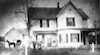
for the older
history of 1261 Western Avenue, William and Caroline Knowles
house from 1895-1926
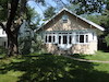
for the older
history of 16 Elmwood Street, built 1914
Census notes
The Federal census of 1940 and previous enumerations are now public
documents.
US Federal Census provides a good overview and
links to the data for each census.
New York also conducted a census up to 1925.
New York Census provides a good overview and
links to the data for each census.
City Directory notes
A city directory for Albany has been published annually (with rare
exceptions) since the early 1880's.
From 1931, the Albany city directory contains a listing by street of
the owners and/or renters of houses on some streets in McKownville:
a) on side streets west to Elmwood Street (but not including Fuller
Road) and along the north side of Western Avenue to Fuller Road;
b) houses and side streets on the south side of Western Avenue to
McKown Road (but not including McKown Road and westward).
The Colonie (+Guilderland) city directory starts in 1957 and
continues; this includes all the McKownville streets.
Albany city directories prior to 1931 do contain information for
some residents of McKownville in the alphabetical by name listing,
but the home address is often not specific ("McKownsville", "RD1",
"Guilderland beyond city line", etc), or omitted. However, if an
individual does appear, his or her occupation is commonly listed.
Deed information, lot maps notes
Deed books and indexes to the deed documents can be viewed at the Albany County Clerk's Office. Documents are
online for 1980 and later; older deeds from about 1960-1980 can be
seen there in bound books; deeds prior to 1960 can be viewed on
microfilm. All indexes to deeds, and to property maps, are available
to view in printed bound books at the Albany County Clerk's office.
For bound deed books prior to 1960, you have to visit the Albany County Hall of Records and request to
view specific volumes. The Hall of Records has deed indexes on
microfilm available to view for years prior to 1980.
In 2019, the Hall of Records had free and convenient parking, and
was set up so research by ordinary people was not difficult, and it
was usually not crowded.
Access to and working in the County Clerk's office could be less
convenient. *Check the websites for current access restrictions
before attempting to visit*
The index file linked above for deeds to properties in McKownville,
is just for the area north from Western Avenue, east of Fuller Road,
and prior to 1931, or first owner for some houses built up to 1937.
Some more recent deed data is included where it was required to
track back to older sales. Houses built later than 1937 in the area
researched are included but without deed information.
This file includes the inferred build date for the houses in this
area; this date is based on the integrated deed, city directory, and
census information and in many cases is not the same as the date in
the town assessor's records.
Lot maps for McKownville, area north from Western Avenue, east of
Fuller Road; these were scanned from available sources, not ideal in
quality in some cases.
return to history page