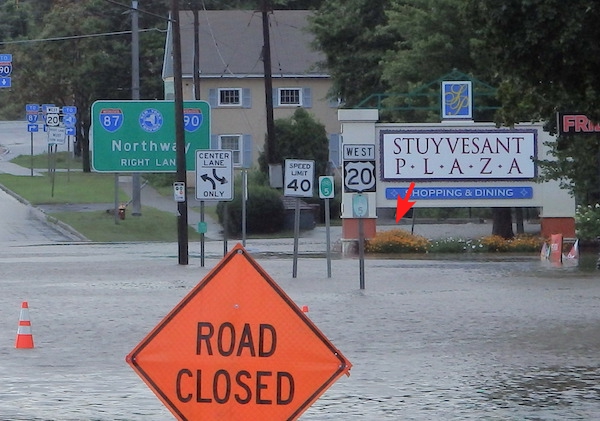
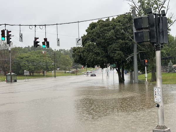
Flooding on Western Avenue at the Fuller Road intersection

Western Avenue flooded and closed at the Fuller Road intersection,
about 7pm, 4 August 2020.
Hurricane/tropical storm I (Isaias); about 4 inches of rain fell
here in the preceding 12 hours.
Closures due to flooding here of Western Avenue, a main emergency
route, have happened repeatedly in
the past. They have probably been reduced in
frequency, by the $600K project completed in 2010 in which the
reservoir was drained and converted to a wetland functioning as a
retention pond, with rebuilding of the internal and outlet culverts.
To prevent these flooding events more effectively the undersized pipe that runs below the
Stuyvesant Plaza Western Avenue entrance would have to be replaced.
There seems to be a reluctance to do this, because of the extended
disruption to traffic and the expense of the construction project
that would be necessary.
see also 18 July 2023;
and 28-29 July 2026;
it will only stop when the drain from the former reservoir is
enlarged
enlarged portion of the same picture, showing water cascading over
the retaining wall at the eastern end of the former
McKownville Reservoir (red arrow points to the top of this cascade),
with flow sufficient to be the principal source of this flooding of
Western Avenue.
Run-off from the impervious surfaces of Crossgates Mall and Commons,
and lesser amounts from Stuyvesant Plaza, and the local parts of the
Thruway and Northway, are the main sources of
this floodwater.
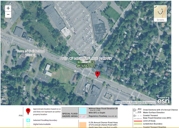
For entertainment, if nothing else, the current output of the online FEMA flood hazard map for this
intersection.
To be fair, they do provide a disclaimer elsewhere that local
sources of flooding other than normal floodplain inundation are not
included in their assessments.......a good lesson that it is wise to
examine the assumptions behind any predictions made by others.

plan from 2009 of the eastern end of the
McKownville Reservoir showing the location (purple line) of the
undersized 24" (RCP) reinforced concrete outlet pipe not replaced in
the 2009 project.
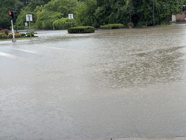
and another event, in the late afternoon of
18 July 2023; there were over 3 inches of rain locally, in an
interval of about 1½ hours.
These pictures were taken about 8pm, about 1½ hours after the rain
ceased. [pictures credit: Susan Anderson]
1. Western Avenue - Fuller Road intersection
2. Stuyvesant Plaza exit to Western Avenue
3. Flood water spilling from the former McKownville Reservoir dam
(located to the right) into Western Avenue


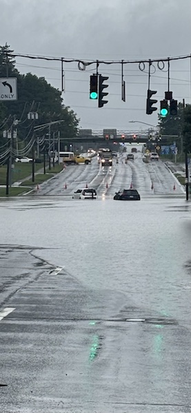
and another flood event, overnight 28-29
July 2026, more than 5 inches of rain to 9am; (just a
slow-moving depression/frontal system, not a hurricane remnant).
pictures of the same Western Avenue-Fuller Road intersection taken
just after 9am by Mickey Cleary.
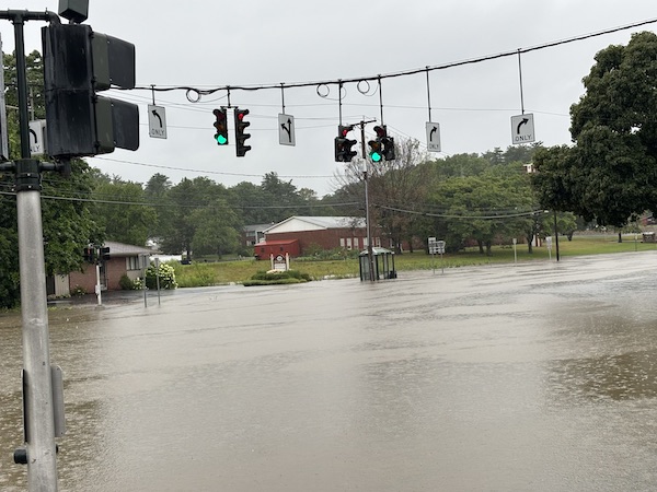
[two cars driven into and stalled in the waters this time; global
climate heating increases, and stupidity also?!]
return to McKownville local history
page
McKownville Improvement Association index
page