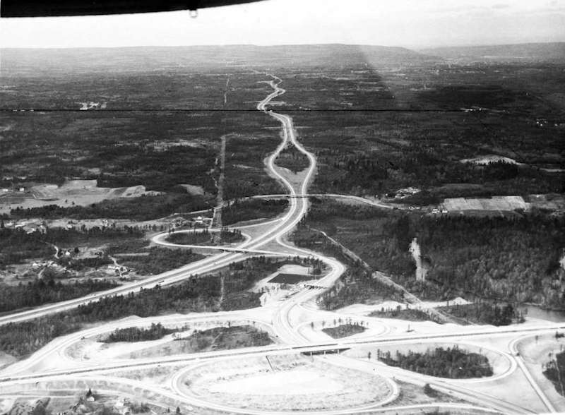
Oblique airphoto view west taken in 1959 over NYS Thruway exit 24
and Adirondack Northway-interstate 90 interchange.
A largely undisturbed area of the Albany Pine Bush is seen in the
center of the picture on both sides of the NYS Thruway (construction
completed in 1953); Washington Avenue extension was not yet built,
and the City of Albany Rapp Road landfill had yet to appear. The
mouth of the Mohawk Valley and the City of Schenectady are located
in the upper right in the far distance.
The black line crossing the image in the upper part is an ink line
drawn on the original photo, marking the location of the western
boundary of the City of Albany.
From the archive of Don Reeb.
return to McKownville
older buildings photo index page
return to McKownville Improvement
Association index page
