Where is McKownville? - maps of the area since 1866
The earliest documented mention of the name is as a US Post
Office, established 7 January 1862.

This was provided space in the McKown Hotel at the
intersection of what is now Fuller Road and Western Avenue (then an
unnamed dirt track, and the Great
Western Turnpike).
While not itself named on the map, a Post Office (P.O.) is
identified at this location on the map of Guilderland published in
1866 by S.N. & D.G. Beers as part of a portfolio of maps of
Albany County.
A[lexander] Gifford is listed as the hotelkeeper (tenant) of
McKown's hotel in the 1865 NY census, but he was not the postmaster.


The first map showing the McKownville name is the US Geological
Survey 15 minute quadrangle map of Albany, surveyed in 1891, and
published in 1893.
The name is shown extending east from the Fuller Road - Western
Avenue intersection. All subsequent USGS topographic maps show the
name placed not far from this position.

Julius Bein's map of Albany, Rensselaer and Columbia Counties, in an
atlas published 1895, shows McKownville referring to the settled
area around the Fuller Road-Western Avenue intersection (marked
black here along the roads).

McKownville on the 1927 USGS 15' Albany quadrangle;
name placed east of Schoolhouse Road intersection.
This map failed to show Elmwood Street, which had been in existence,
with one house on it, since 1914.

McKownville on the 1950 USGS 15' Albany quadrangle;
name placed east of Fuller Road.

McKownville on the 1953 USGS 7½' Albany quadrangle;
name placed east of the NYS Thruway.

McKownville on the 1994 USGS 7½' Albany quadrangle;
name placed east of the Adirondack Northway and the NYS Thruway.

Mckownville on 1996 USGS topo map base, annotated for 2006
drainage/flooding study;
name placed east of Schoolhouse Road

Town of Guilderland interactive mapping site - screen capture
2020-08-14
McKownville label at the Fuller Road-Western Avenue intersection

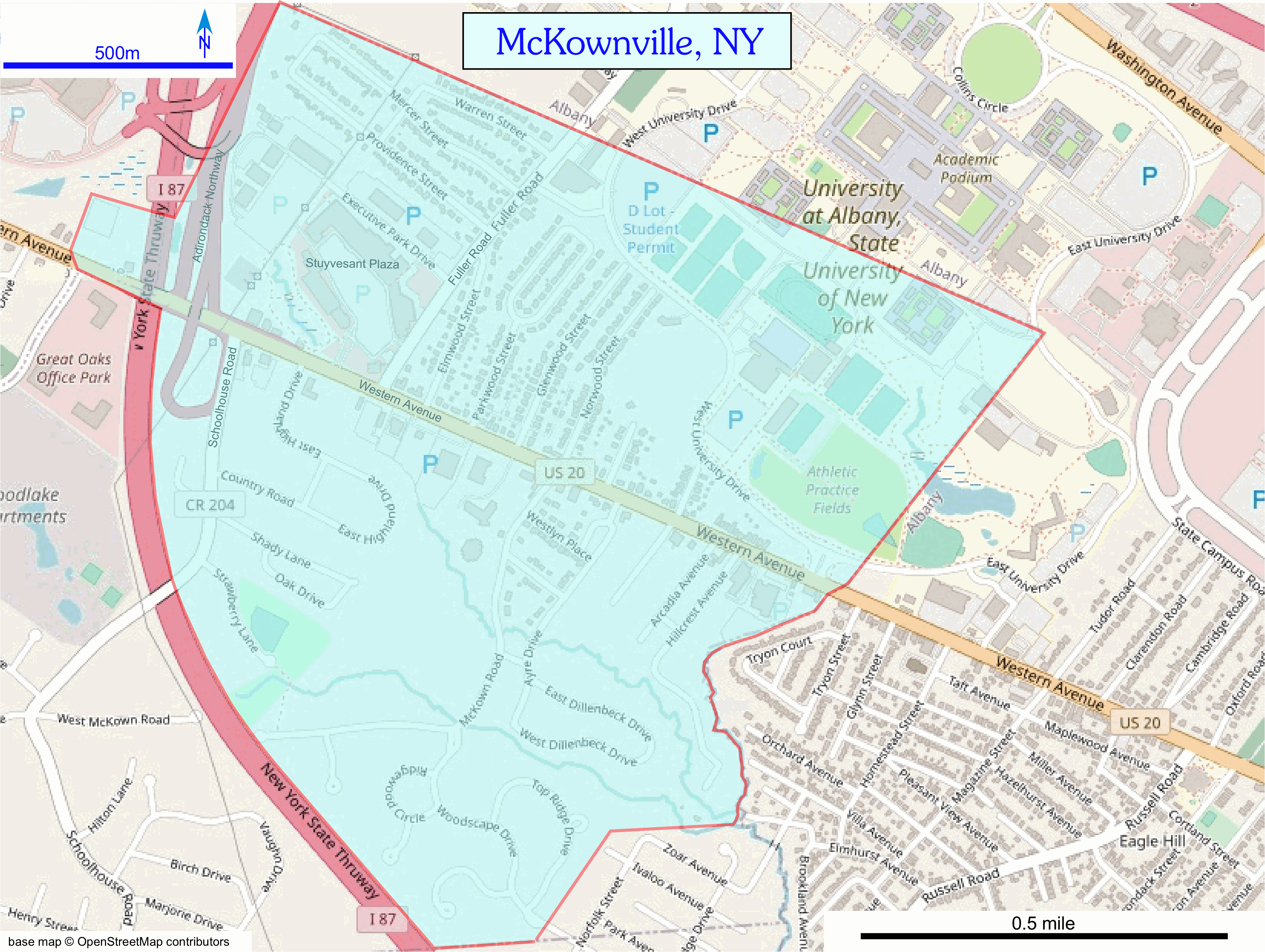
McKownville extents shown on 2020 OpenStreetMap base
refer to neighborhood description
page for more information
Map base from openstreetmap.org; Creative Commons Attribution-ShareAlike 2.0
license (CC BY-SA)
return to McKownville local history
page


