Guilderland
Historical
Society
- Guilderland properties listed in the
National Register of Historic Places - McNiven Farm
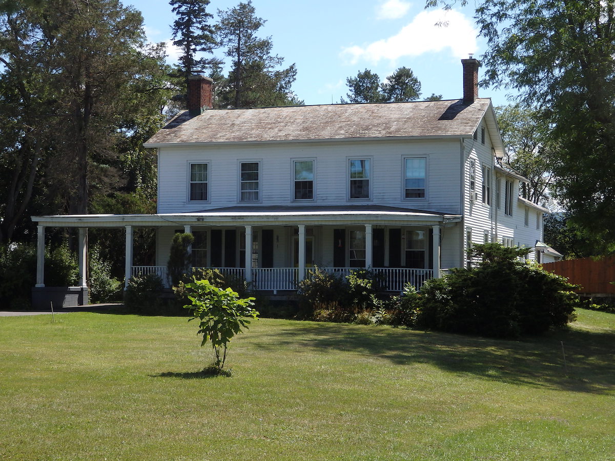
The McNiven Farm house viewed from the northwest (August
2025).
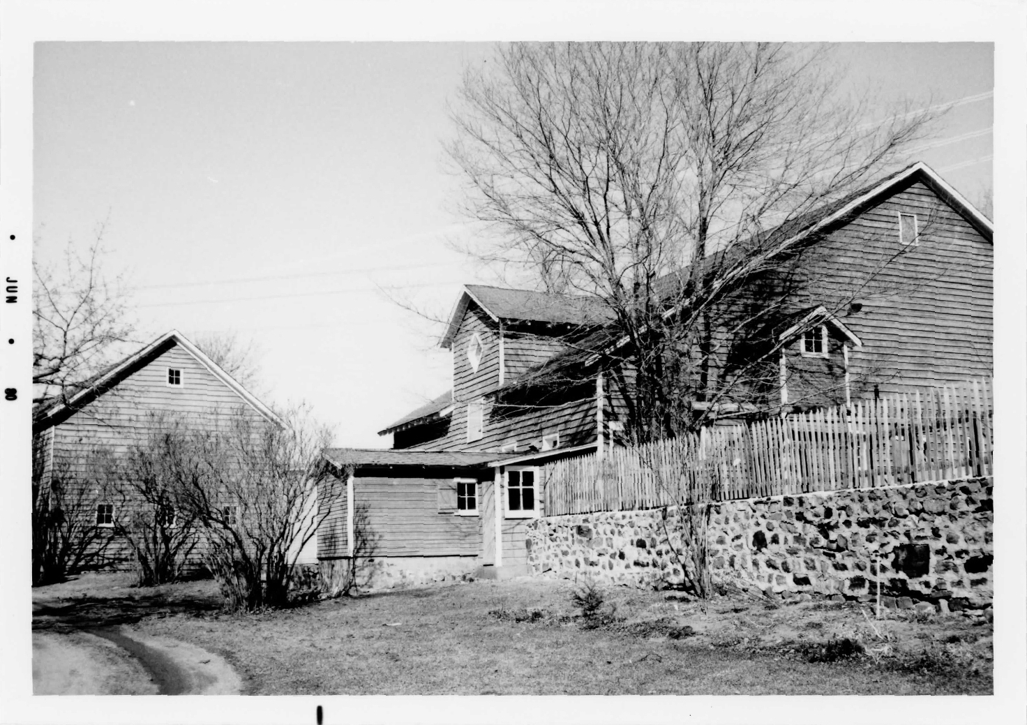
Photos of the McNiven Farm in the 1982 NRHP nomination document (2,
3 marked May, June 1980)
click on an image to obtain full size view
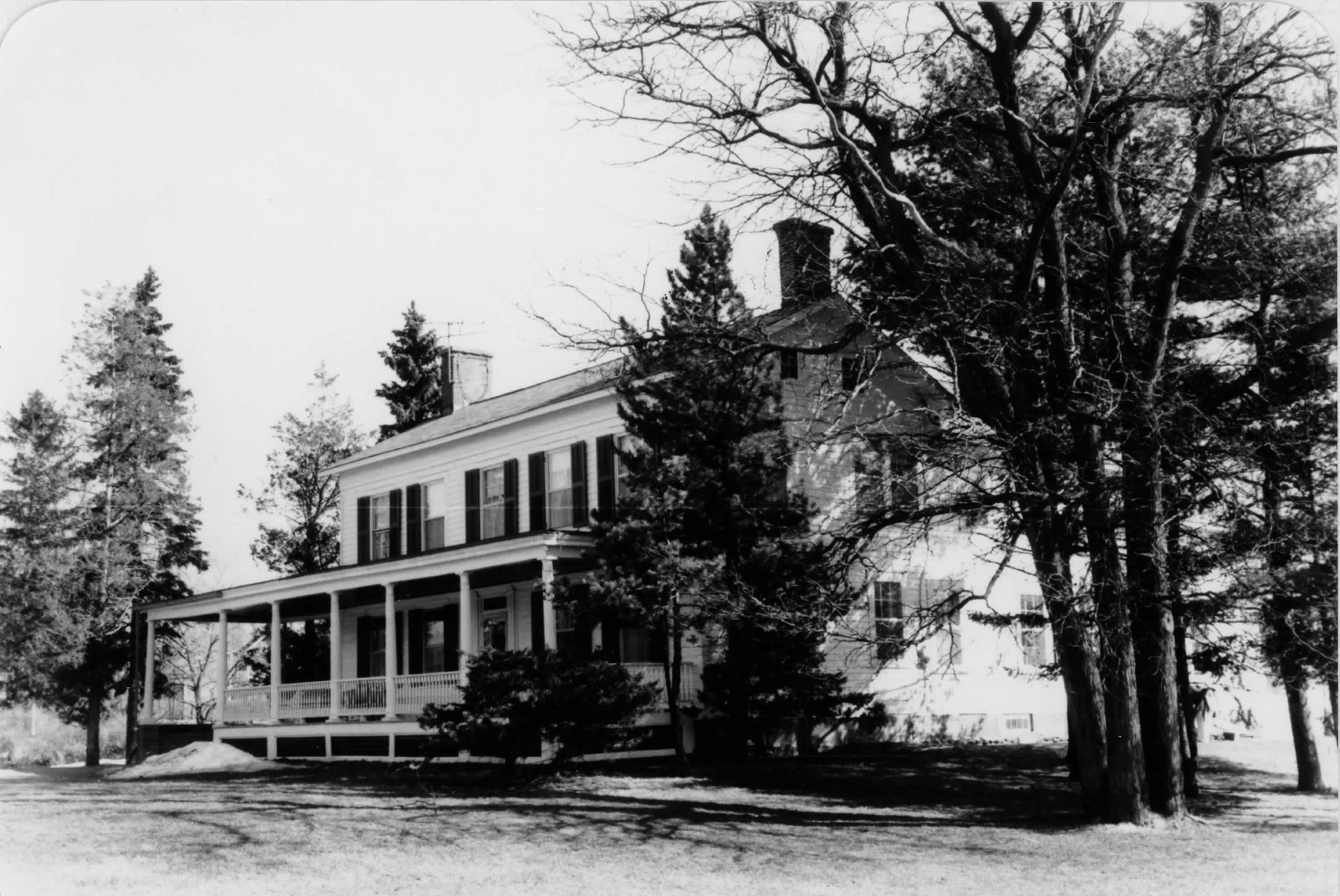
1. McNiven Farm house viewed from the west
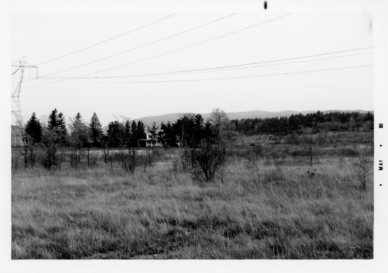
2. the house looking south from Altamont Road
3. Barns to the east of the house
Text information from NRHP nomination of 1982
McNiven Farm entered on the NRHP 10 November 1982
Application file # 27; National Register Guilderland Multiple
Resource Area # 4.
Set very far off the road [Rte 146, Altamont Road]; still retains
its original farm setting. Major electric power transmission line
corridor nearby (see photo 2).
Features: Two-story farmhouse, five bays wide with center
entrance and gable roof; one-story porch across front extending east
to form a porte-cochère; two-story ell on rear; interior remains
largely unaltered; evidence of a small 18th-century house on rear.
Date of initial construction: ca. 1860 (rear 1790's).
Historical and Architectural importance: The original
building was a small Dutch house located to the rear of the present
structure. As the farm grew the substantial addition was constructed
in the 1860's. The house is largely unaltered and is an excellent
example of restrained rural farmhouse of the 19th century. It
reflects Guilderland's heritage as a rural, agrarian community of
the eighteenth and nineteenth centuries. The barn complex is of a
notable vernacular design. Both the farmhouse and barns survive
amidst contemporary suburban development. The buildings display a
significant degree of integrity.
McNiven Farm
NRHP nomination document (10MB pdf)
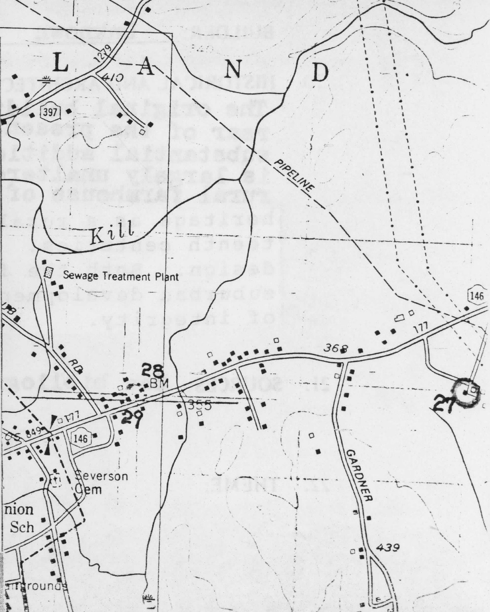
map location from NRHP document (#27 McNiven
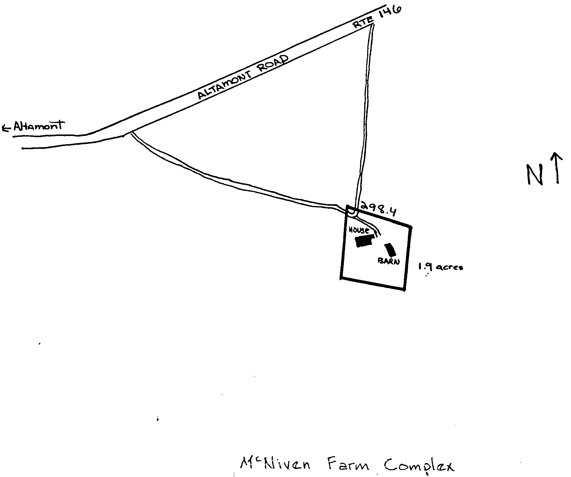
Farm) site map with building location from 1979 tax map
Google Earth kml
file
Guilderland NRHP properties
Guilderland Historian
Guilderland Historical Society