Guilderland
Historical Society
- Van Bael Patent proposed marker text and supporting
documents
Van Bael Patent - revised proposed marker text

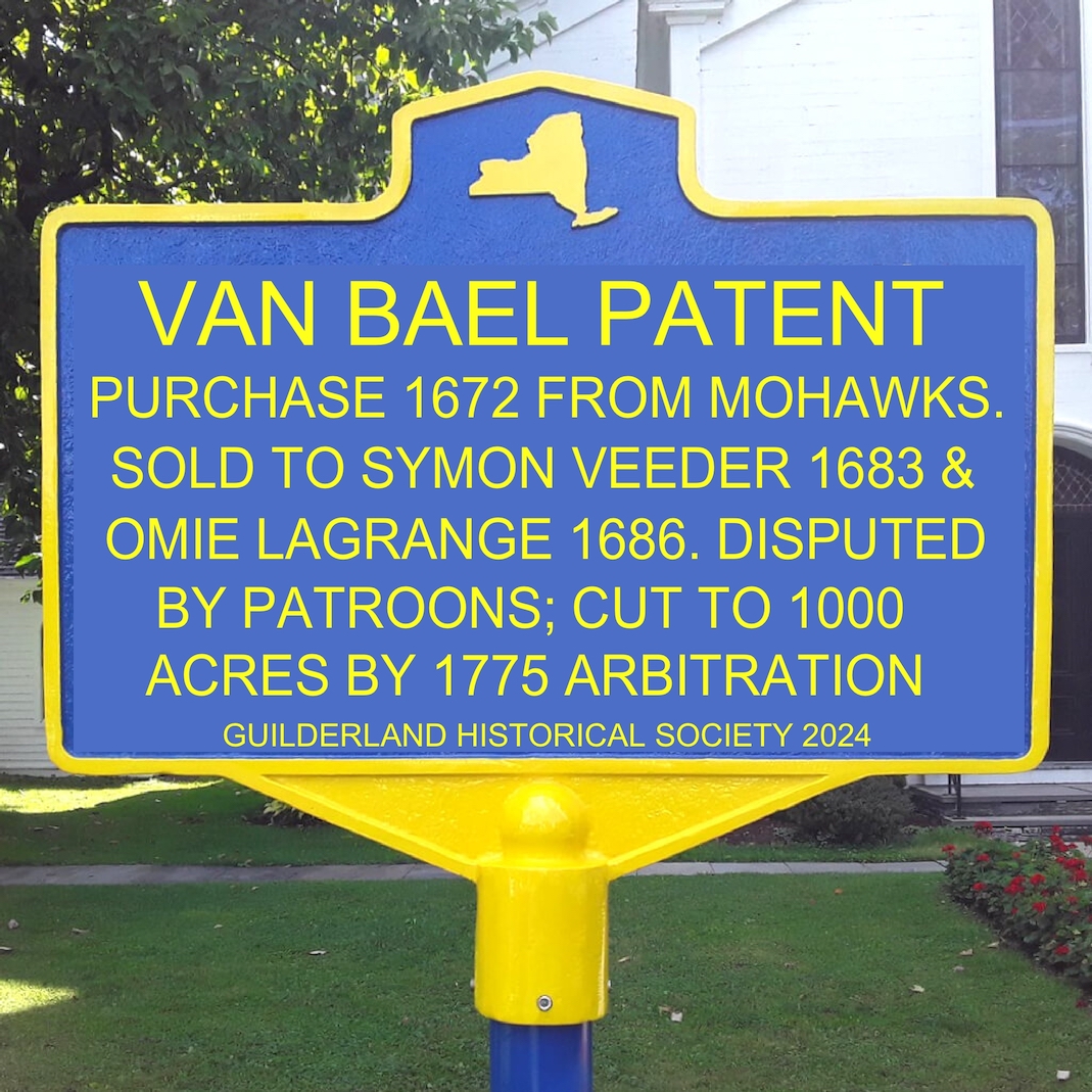
VAN BAEL PATENT
PURCHASE 1672 FROM MOHAWKS.
SOLD TO SYMON VEEDER 1683 &
OMIE LAGRANGE 1686. DISPUTED
BY PATROONS; CUT TO 1000
ACRES BY 1775 ARBITRATION
mockup image of proposed marker
Supporting documents:
PURCHASE 1672 FROM MOHAWKS
1) Deed to Jan Hendrickse Van Bael, 18 July 1672, including map
Reference and transcription in Dennis Sullivan manuscript (2019)
[VanBaelPatent16720718deedtext.pdf]
The definition of the patent in this document requires that it was a
square, and must have contained at least 36,000, and quite probably
50,000 acres, essentially most or all of the land within the
Normanskill valley for a distance of 7 to 10 miles west from Albany.
2) Patent confirmation to Jan Hendrickse Van Bael, 21 August 1672
documents in the NY State Archives:
[NYSA_A0487-78_Vol5b_p91-92.pdf]
A0487-78, Letters Patent – Volume 5B, Page 91-92 [this document made
from the original in 1711]
[12943-78_Vol4_p88-89.pdf]
A0487-78, Letters Patent Transcribed Pursuant to an Act of 1786 –
Volume 4, Page 88-89 [copied from the 1711 document]
"...Jan Hendricks Van Baal hath made Purchase of the Indian
Proprietors of the Maquis*......the said Indian Proprietors Names
who made Sale of the said Land and sett to their Marks for the
Conveyance thereof being Canachko, Schaenwino, Canhowadadin, and
Sagodermechta......"
* the tribe later more commonly known as Mohawks
2b) also found in Albany County Deed book 5 pages 438-9,
accompanying deed from heirs of Jan Hendrickse Van Bael to Omie
LaGrange and Johannes Symonse [Vedder or Veeder], dated 6 September
1716
[bk5p438-9.pdf]; transcription [bk5p438-9transcript.pdf]
SOLD TO SYMON VEEDER 1683 & OMIE LAGRANGE 1686.
These two persons each obtained a half of the patent. Both were the
founder of a family group, each with numerous descendants, that
lived and farmed and were well known in the Normanskill valley for
more than 200 years, the area later to become part of the Townships
of Guilderland and New Scotland. Omie LaGrange is also noteworthy
for having lived to the age of 106, according to the record of the Lutheran pastor
of his burial in 1731.
3) sale of half of the patent to Symon Volkertse [Veeder] 26 June
1683
Albany County Deed book 3 page 183 [bk3p183rc.jpg]
photo of the original (in the Albany County Hall of Records);
[bk3p183_x2.pdf] from the best
available public microfilm copy; focus in upper part is very poor.
translation of the deed in Early Records of Albany, volume 2, pages
187-188.
[Pages187-8fromearlyrecordsofalbanyv2.pdf]
this translation made by Jonathan Pearson in 19th century.
4) sale of the other half of the patent to Omie LaGrange 8 September
1686
Albany County Deed book 3 page 322 [bk3p322rc.jpg]
photo of the original (in the Albany County Hall of Records);
transcription of the deed in Early Records of Albany, volume 2,
pages 312-3
[Pages312-3fromearlyrecordsofalbanyv2.pdf]
5) sale and quit claim of the residual interest in the patent by the
heirs of Jan Hendrickse Van Bael 6 September 1716
to Omie LaGrange and Johannes Simonse Vedder (or Veeder); these were
the original 1686 LaGrange purchaser, and the son of Symon Volkertse
[Veeder].
Albany County Deed book 5 pages 439-42;
[bk5p439-42.pdf] [bk5p439-42transcript.pdf]
DISPUTED BY PATROONS
This dispute started sometime early in the 18th century; the
document:
6) An Act to confirm a Submission to Referees of a Controversy
concerning the Bounds of the Patent of Jan Hendrickse Van Baal; pp.
753-766 in Laws of the Colony of New York; Chapter 1703, passed
April 1, 1775
[VanBaalPages753-60fromThe_Colonial_Laws_of_New_York.pdf]
contains on page 757 this summary:
"Whereas divers disputes have arisen by and between the Parties
to these Presents......which Disputes having occasioned great
Expences to the said Parties; For the Prevention whereof for the
future and for settling the said Disputes between the said Parties
they have mutually referred the same to Arbitration by Bonds
bearing even date with these Presents in the penalty of Fifty
Thousand Pounds with Condition as is thereunder written....".
7) The will of Isaac LaGrange (son of Omie), dated 16 April 1761
contains this:
“.. will and express order is that my two daughters Geezee and
Antjie ... shall pay each five pounds current lawful money of New
York towards the defending of this Pattent of Van Balen if so be
that it should ever come to tryall...."
[IsaacLaGrangeWill005114089_00209c.jpg];
the complete document: [IsaacLaGrangeWill.pdf]
8) There are summary records of court proceedings which were indexed
on cards in the 19th century from the original records (those
originals later destroyed in the 1911 NY Capitol fire); these
contain three separate items of the attorney for Jeremiah Van
Rensselaer suing or obtaining judgement on Johannes Simonse Veeder
(son of Symon Volkertse) for Trespass and ejectment, in 1736, 1742,
and 1745; there is also a record for his son Simon Johannes Veeder
being sued by Catherine Van Rensselaer for the same alleged offence
in 1774, the same year that the arbitration was being arranged.
[1736-1774-CourtCards-Veeders.pdf]
CUT TO 1000 ACRES BY 1775 ARBITRATION
The arbitration agreement sets out the procedure and appointed named
arbitrators and a date for them to meet in Albany and take evidence.
9) An Act to confirm a Submission to Referees of a Controversy
concerning the Bounds of the Patent of Jan Hendrickse Van Baal; pp.
753-766 in Laws of the Colony of New York; Chapter 1703, passed
April 1, 1775
[VanBaalPages753-60fromThe_Colonial_Laws_of_New_York.pdf]
A quorum of arbitrators did indeed meet, earlier than specified, and
made a swift and very one-sided decision.
10) The Referees report and decision dated 24th May 1775
Albany County Deed book 10, pages 168-173 [#]
[bk10p168-73.pdf]; transcription [bk10p168-73transcript.pdf]
The primary decision was that the patent was defined by a square of
1000 acres, which is contained by sides of 1.25 miles (100 chains)
length. The ancilliary decision was where this was located, which
the arbitrators defined based on a measure starting at the southeast
corner of the house of Myndert Veeder:
"Beginning at a place eighty four chains distant on a course
south fifty degrees east as the magnetic needle now points from
the southeast corner of the dwelling house at Normans Kill
aforesaid formerly possessed by Myndert Veeder but now or late in
the possession of Volkert Veeder and Abraham Veeder or some or one
of them and running from the said place of beginning first north
forty degrees east fifty chains then north fifty degrees west one
hundred chains then south forty degrees west one hundred chains
then south fifty degrees east one hundred chains and then north
forty degrees east fifty chains to the place of beginning all said
lines to be run as the magnetic needle now points@."
To locate this accurately depends first on identifying the location
of the dwelling house of Myndert Veeder.
Two complementary approaches were used: First, two 19th century maps
show the Van Bael patent with sufficient topographic and survey
boundary detail to locate the patent square adequately such that the
location of Myndert Veeder's house can be reasonably well
approximated. The better one of these is in the Julius Bein atlas of
1895: Map 12; Albany, Rensselaer and Columbia Counties
11) extract from this showing the "Van Ballum" patent outline [Beinmap1895-McKownville.jpg]
Second, it can then be located as one particular house shown
on three more detailed, larger scale maps of the mid-19th century.
Because there were only widely spaced farm houses in this vicinity
during this time, only one house corresponds to the arbitrators
definition. This house is shown on the Beers map of Guilderland of
1866 labelled with the name of "J. Van P." A deed exists in the
books of Albany County showing purchase of the farm on which this
house stood by Josiah Van Patten in 1864, from John and Catherine
Veeder; John was the grandson of the Abraham Veeder mentioned in the
arbitrator's patent definition.
12) Albany County Deed book 205 pages 267-9 [#] [bk205p267-9.pdf]
13) extract from the Guilderland map in the Beers atlas of 1866 [1866Beers-JohnstonRd.jpg]
We have subsequently confirmed this identification from a map of
date c. 1789-1791 found in the NY State Archives which shows the
arbitrators' 1000 acre square and individual farm houses in it. The
Archive index date of the map [1789-02-08] is the same as the deed
from Stephen Van Rensselaer to the Van Bael Patent claimants
awarding them shares in a larger 5.25 mile square centered on the
small one; this larger square forms the boundary of this map, likely
made to accompany the deed.
14) Albany County Deed book 17, pages 376-81 [#] [bk17p376-81scan.pdf] and transcript
[bk17p376-81transcript.pdf]
15) Map of Jan
Hendrick Van Baal’s Patent, February 8, 1789.
NY State Archives A0453-79, Record of Deeds, Mortgages, Regents
Charters, and Other Documents – Box 32, Volume 38, Page 446.
Extract from this map showing the arbitrators' 100 chain-sided
square (1000 acres) and the houses contained in it:

The present owner of this property, Raymond Greene Jr, reports that
an old field stone foundation is incorporated into his house, and
this is the position as shown on the 18th and 19th century maps for
the one selected to define the arbitrated patent.
Because this is the place used by the arbitrators to locate the
arbitrated patent, it is a most appropriate property on which to put
the proposed Van Bael patent historic marker.
Mr Greene is agreeable to having the proposed Van Bael Patent
historic marker installed on his property, near the county road, now
called Johnston Road, formerly Normanskill Road (Albany County Route
203). It will be clearly visible and readable from the road.
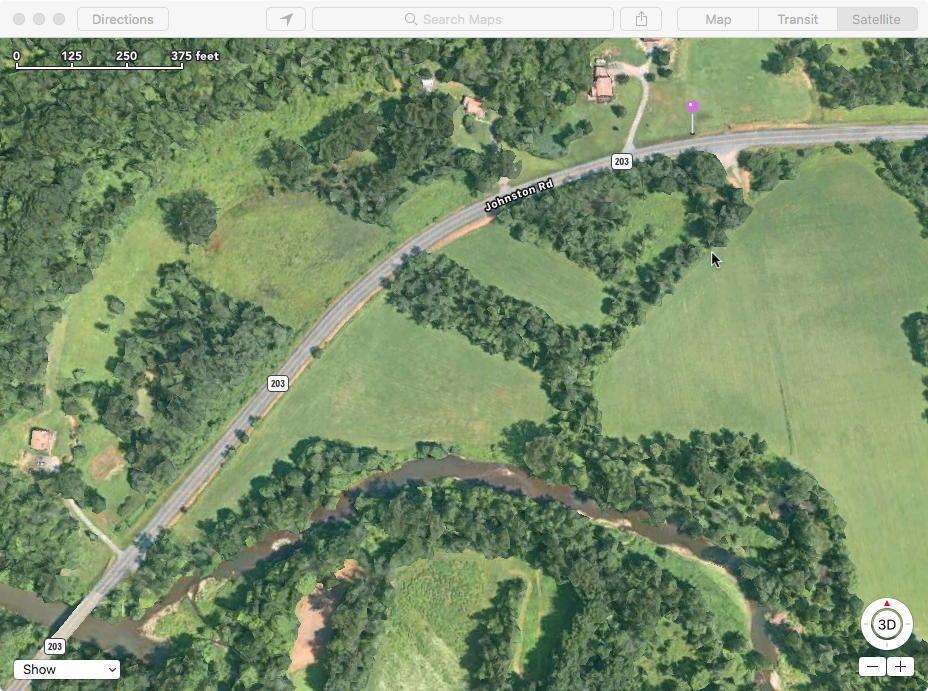
Proposed location: 42.670179°N, 73.891132°W
14) satellite view extract from Apple Maps [VanBaelPatentMarkerloc.png]
Bridge over the Normanskill at lower left; marker location given by
purple pin in upper right of image

# Please note that most of the Albany County deeds dated before 1874
were transcribed to typescript sometime in the earlier part of the
20th century and the original handwritten versions are apparently
not available.
@ The declination of the magnetic field here in 1775 can be obtained
online from the National Geophysical Data Center website:
https://ngdc.noaa.gov/geomag/declination.shtml
This shows that these 1775 magnetic bearings are 6.25 degrees
farther west than the bearing values to geographic north. Thus all
the direction specifications for the patent need to be rotated 6.25
degrees counterclockwise (e.g. N 40 E to N 33.75 E) to place them
accurately on a present day topographic map.
More detailed information on and discussion of the Van Bael Patent,
Jan Hendrickse Van Bael, and the LaGrange and Veeder families is
located on these web pages:
https://mckownville.org/historypages/MIA-VanBaelpatent.html
https://mckownville.org/historypages/MIA-VanBaelbio&sources.html
https://mckownville.org/historypages/MIA-NormanskillPeople.html
prepared by William Kidd; 3rd draft document 2024/09/05 with NY
State Archives Patent confirmation documents, 1789 map, and related
deed added.
[1st draft with older proposed
marker text]


