Guilderland
Historical Society
- Guilderland historical highway markers
Historical highway markers in the Town of Guilderland
Alice Begley as Town Historian wrote a booklet listing all the
roadside highway historic markers in the Town of Guilderland,
published in 1994.
This contains an historical description for each marker, adding
significantly in most cases to the inevitably limited text on the
marker itself, and a map showing the locations. These individual
descriptive pages are linked through the black/white outline images
taken from the booklet and used below.
Some markers have been added since its publication, and are included
in this collection. This list approximately follows the order in
Begley's booklet, which was intended to allow an itinerary
minimizing reversals and side excursions. The newer markers have
been inserted among the 35 originals
at the appropriate places to maintain this ordering. The original
markers are listed with the same numbers used by Begley; newer and
other markers not in her listing are given block letter identifiers
A, B, etc.
Guilderland highway markers are in excellent condition, as can be
seen by comparing the photos here (mostly taken in 2024) with older
ones in the HMdb.org site. This is due to the dedication of John
Haluska who undertook single handed a program of refurbishment over
the past few years.
Two images used here have been borrowed from an extensive and
excellent website [HMdb.org] with
national coverage of roadside historical markers, and which
also includes other kinds of public historical plaques and signs.
These borrowed images are each accompanied by an attribution and
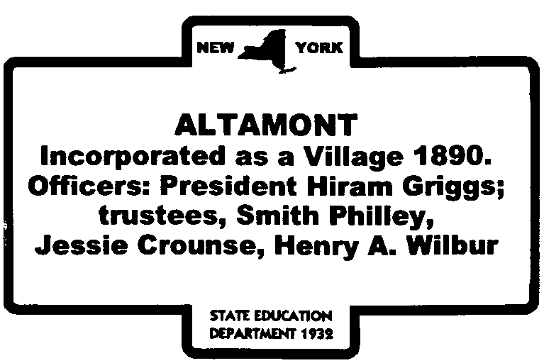
link to the HMdb.org item from which it comes; retain these
attributions to conform with the HMdb.org
copyright. All the other photo images were taken specifically
for this website page; permission for re-use is for non-commercial
uses only, with an accompanying attribution to the Guilderland
Historical Society and a link to this page beside each image used.
Photo images below contain a link to the HMdb.org page for that
marker, if one is available; click on the photo to go to that
website page, opening in a separate tab/window.
All the marker drawings below contain a link to a pdf file
containing a scan of the explanatory text page for that marker in
Alice Begley's booklet.
click on the drawing image to access the pdf file; an example linked
drawing image is here:

A link to a clickable map containing symbols each linked to
information for that marker is provided here (click on the map image
to access):
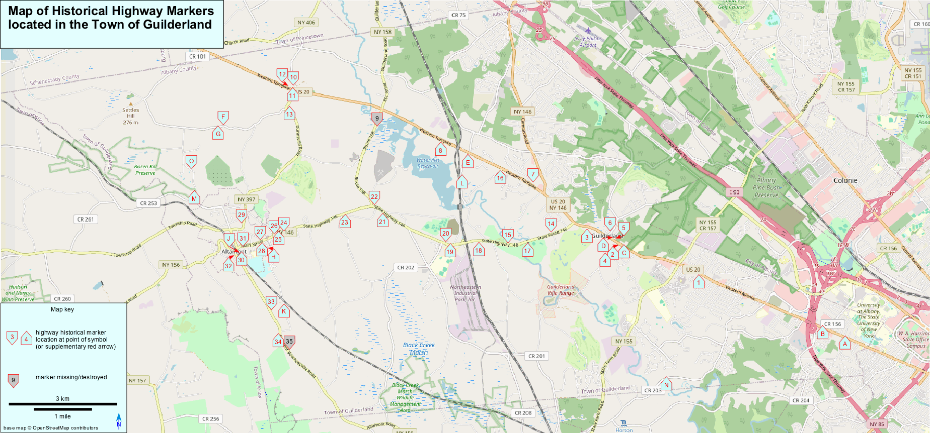
Locations of all the markers are included in these Google Earth kml
location files: [named
markers]; [marker numbers]
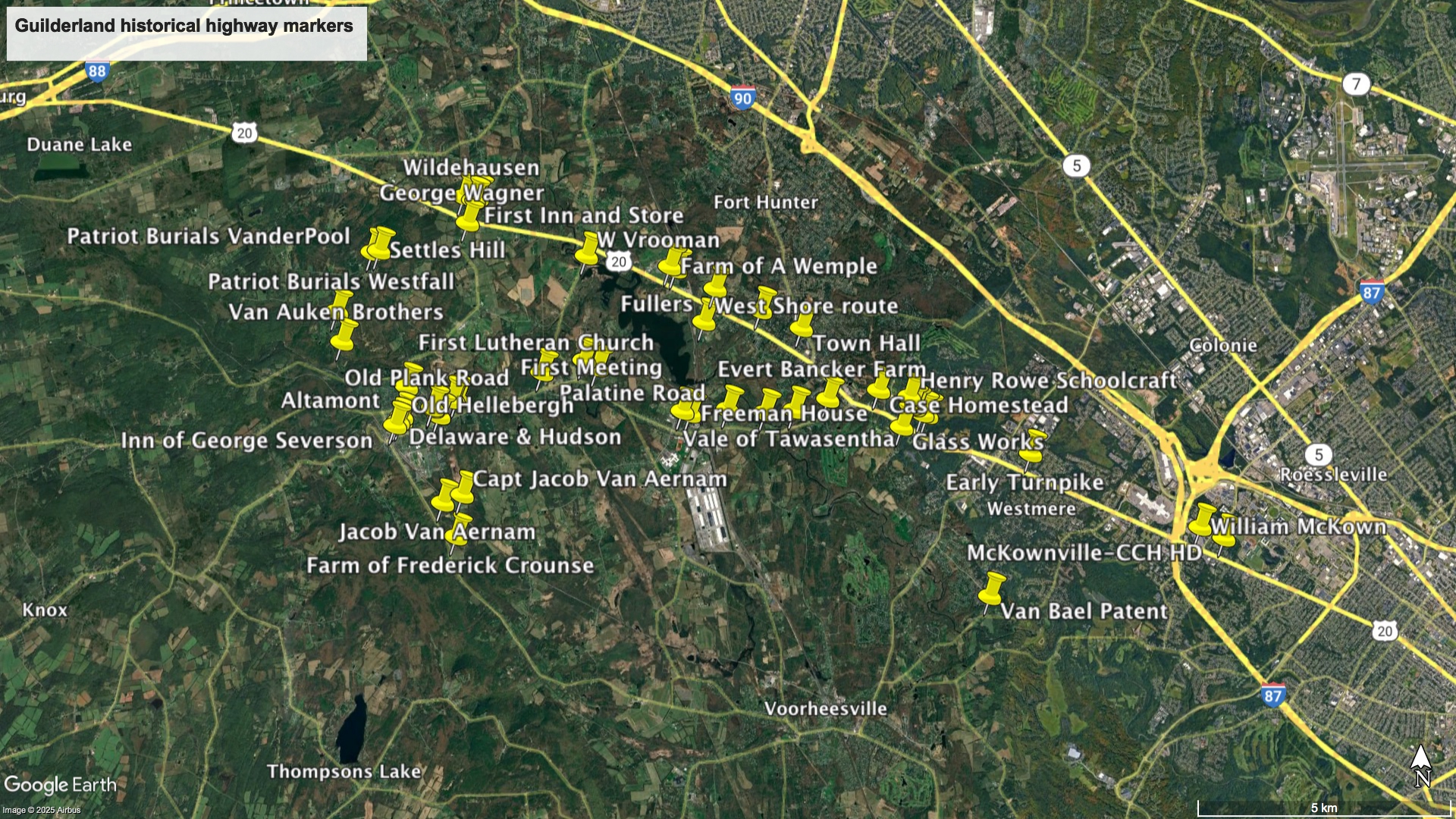
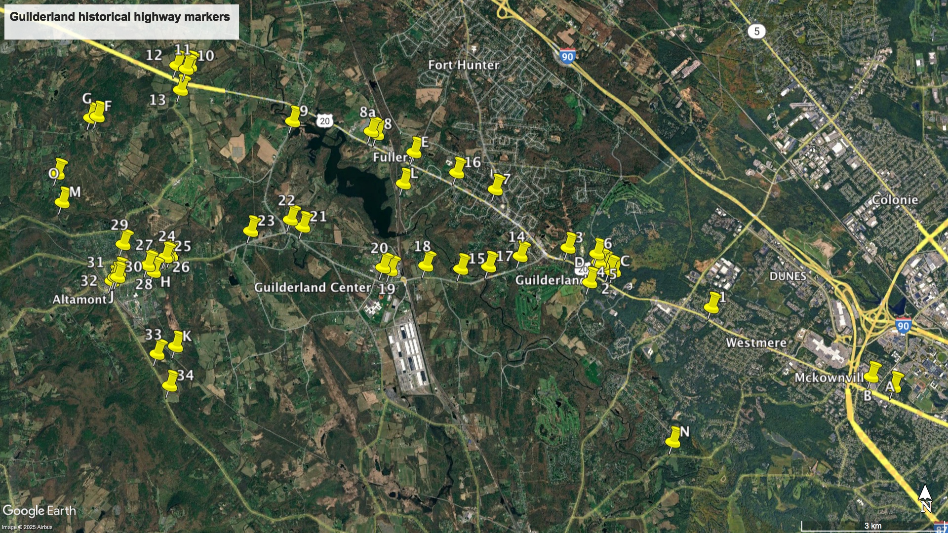
Map images from Google Earth showing the markers
[map with names] [map with numbers]; these
are image files that can viewed on screen or printed as a single
page.
--------------------------------------------------------
The first group of historic markers consist of those on or near the
main highway of US Route 20, heading westward from the eastern part
of the Town of Guilderland; they include one exception located to
the south near the Normanskill creek, which would require a side
trip of 2.4 miles down Johnston Road.
A) McKownville - Country Club Highlands
Historic District. The district was added to
the National Register in 2022, and the marker, funded by the William G Pomeroy Foundation, installed in
2023 at the corner of Glenwood Street, on the north side of Western
Avenue (US Route 20). The District contains 106 houses (95 classed
as contributing) built in the first half of the 20th century on five
side streets and the frontage of Western Avenue, between Knowles
Terrace and Elmwood Street.
 More information
is in the McKownville Improvement Association website;
see also in the Pomeroy Foundation website
More information
is in the McKownville Improvement Association website;
see also in the Pomeroy Foundation website
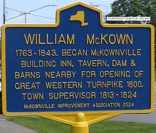
B) William McKown. A new
marker installed by the McKownville
Improvement Association in 2024 on the occasion of its 100th
anniversary. North side of US Rte 20, 500 ft west of the Fuller Road
intersection. Funded by contributions of residents and a local
business. Made by Catskill
Castings, the successors to the foundry which made the markers
for the New York State program 1925-1959.
 More information is
in the McKownville Improvement Association website
More information is
in the McKownville Improvement Association website
N) Van Bael Patent. New marker
obtained by the Guilderland Historical Society with grant funding
provided by the William G Pomeroy Foundation and installed in
2025.
North side of County Rte 206, Johnston Road, about 0.4 mile east of
the bridge over the Normanskill creek.
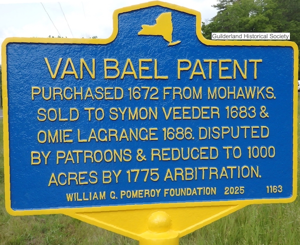 view the page in the Pomeroy Foundation website
; more information at the McKownville Improvement Association website
view the page in the Pomeroy Foundation website
; more information at the McKownville Improvement Association website
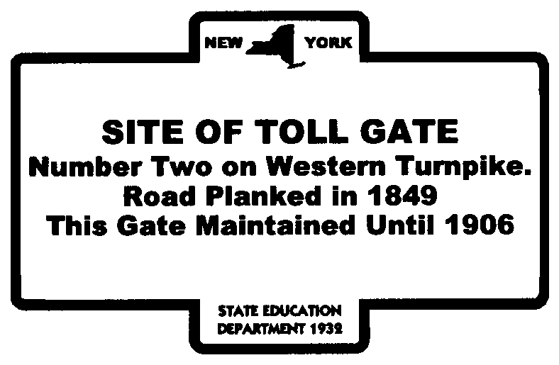
1) Tollgate #2 (Early Turnpike).
The original marker* disappeared from the site on the south side of
US Route 20, ½ mile east of the NY Rte 151 intersection. A
replacement was obtained by the Guilderland Historical Society, with
grant funding provided by the William G Pomeroy Foundation and installed in
2023 at the same location as the old one. The wording differs from
the original, from review and editorial changes requested by the
Pomeroy Foundation.
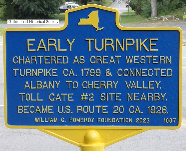
 see also the page in the Pomeroy Foundation website
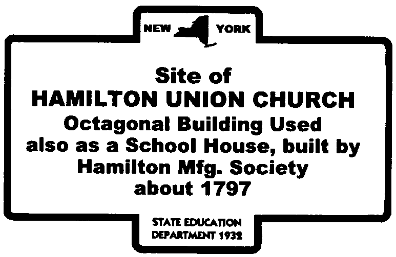
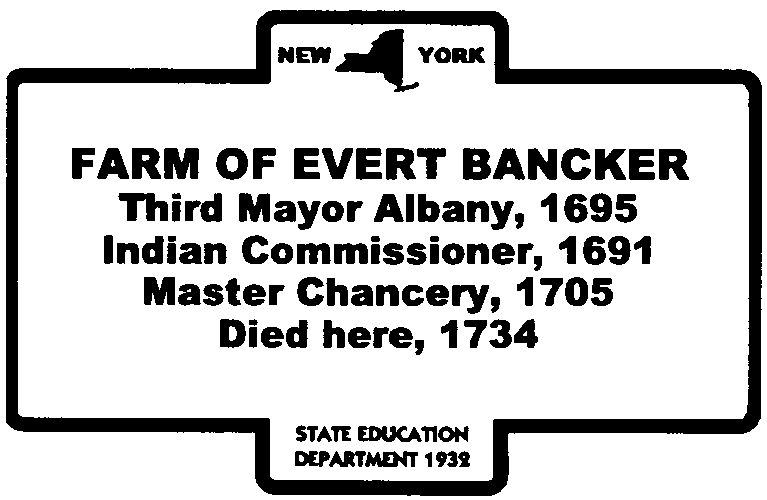
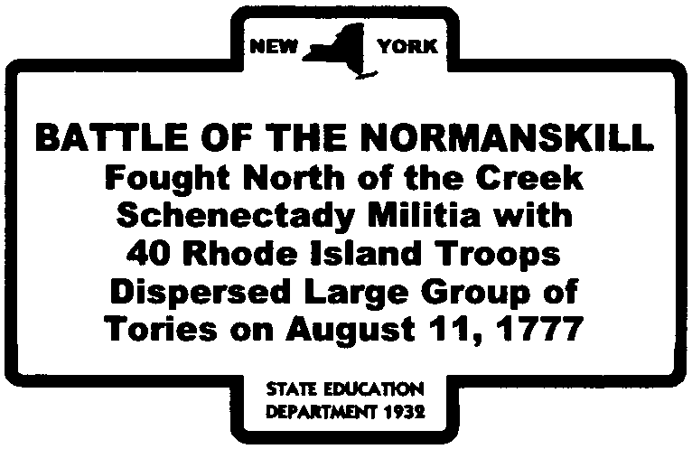
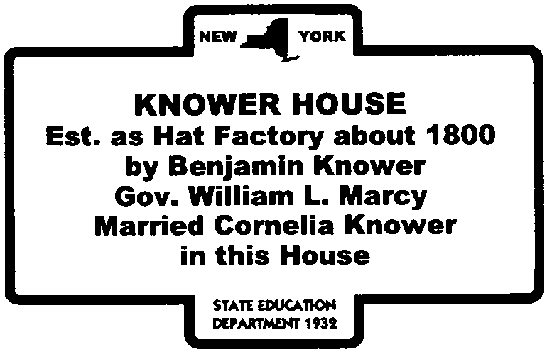
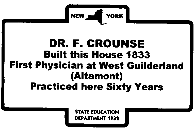
* Begley illustrated the booklet with a drawing of each marker,
containing the text placed in a standard template. While many of the
original markers were provided through the New York State program,
not all of them were obtained in 1932 (the template date). Also,
markers provided by other organizations, mostly after the State
program ended in 1959, are shown in the same template; these
discrepancies are indicated where appropriate in items below.
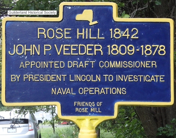
C) Rose Hill. N
side of US Rte 20, about 0.2 mile W of traffic light intersection at
Winding Brook Drive. Installed by Friends of Rose Hill (probably
later than 1994, as it is not in Begley's booklet).
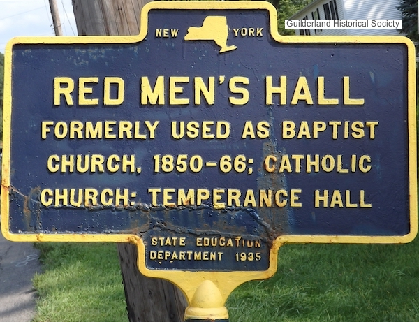
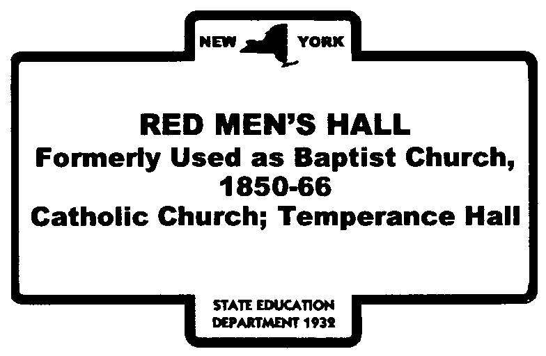
2) Red Men's Hall. S side of US Rte 20,
about 0.25 mile W of traffic light intersection at Winding Brook
Drive.This is the original, but now perilously closer to the
shoulder of US Rte 20 than it was when installed, due to widening to
four lanes in the 1940's.
Obtained in 1935 from the New York State marker program.
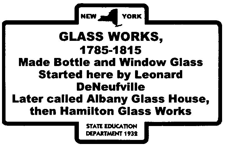
4) Glass Works. The present
marker was installed by the Town of Guilderland in 1985, on the east
side of Foundry Road, 1/3 mile south of the intersection with US Rte
20. It is a replacement for the original.

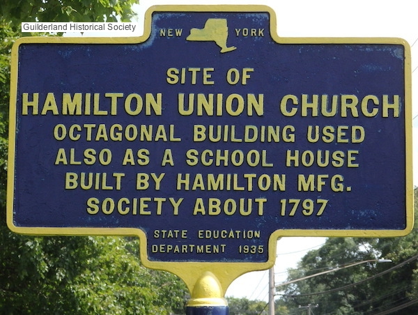
5) Hamilton Union Church (site
of). Obtained in 1935 from the New York State marker program. North
side of US Rte 20, east of Schoolcraft Street intersection.
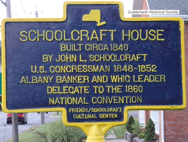
D) Schoolcraft House. Marker
sponsored and installed by Friends of Schoolcraft Cultural Center
(later than 1994). N side of US Rte 20 at Schoolcraft Street
intersection.
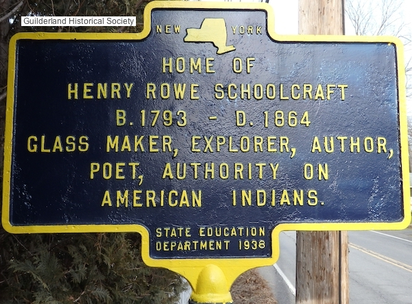
6) Home of Henry Rowe Schoolcraft.
Original marker obtained in 1938 from the New York State marker
program. West side of Willow Street adjacent to the (presently)
yellow house, 0.1 mile north of the intersection with US Rte 20. He
was also a geologist and mineralogist and, using a recently popular
general term, certainly a polymath. He lived here only until 1809
(age 16), and did not return, except for an occasional visit.
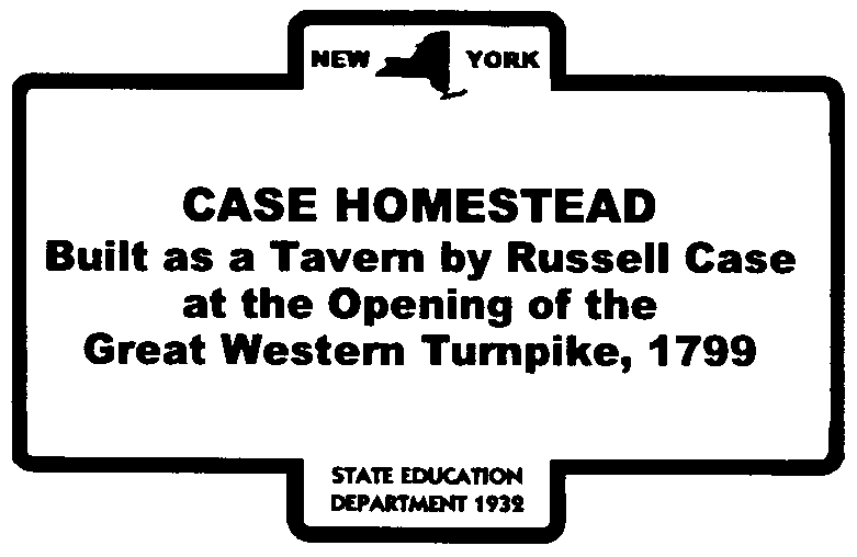
3) Case Homestead.
Another original marker on the south side of Rte 20, 0.2 mile east
of the intersection with NY Rte 149 at Hartmanns Corners. This one
only narrowly survived damage by a vehicle, and was repaired by a member of the Guilderland Highway
Department. Now lacking its State Education Department
footer as a result of this incident.
The Turnpike was chartered in 1799, but this eastern section was
opened to traffic in 1800. Some parts farther west were not
completed until 1804.

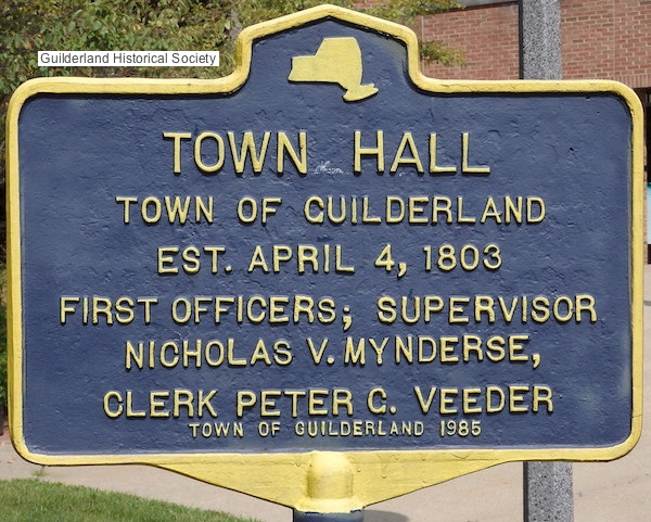
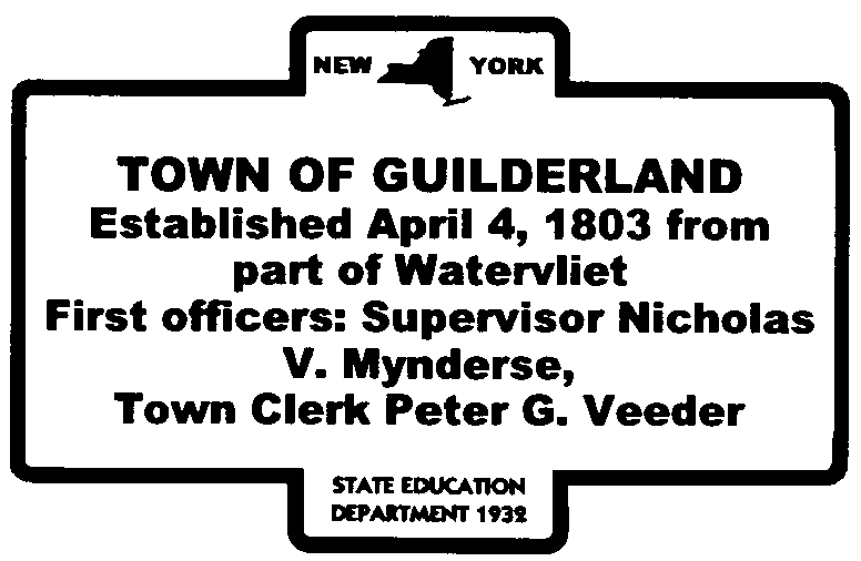
7) Town Hall (Guilderland). In front of the
Town Hall building, set back from US Rte 20, N side. Marker obtained
by the Town of Guilderland in 1985. The differences in the title and
text of the marker as illustrated, compared with the actual sign,
probably result from changes in the year between the booklet being
written and the sign manufactured. If an older one existed, it was
located elsewhere, and not preserved.
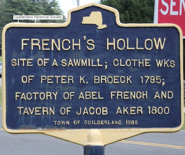
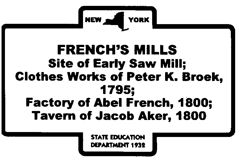
16) French's Hollow
(originally French's Mills). The original marker close to the former
site of the Mills near the Normanskill has vanished; the 1985
replacement by the Town of Guilderland was put in a different
location, W side of French's Mill Road at the intersection with US
Rte 20.
E) Fullers. New marker obtained by the Guilderland Historical
Society with grant funding provided by the William G Pomeroy Foundation and installed in
2023. S side of US Rte 20 at the Fuller Station Road intersection.
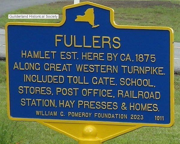 view the page in the Pomeroy Foundation website
L) West Shore Route. New
marker obtained by the Guilderland Historical Society with grant
funding provided by the William G Pomeroy Foundation and installed in
2025.
Located on the east side of Fuller Station Road 0.44 mile south of
intersection with US Rte 20.
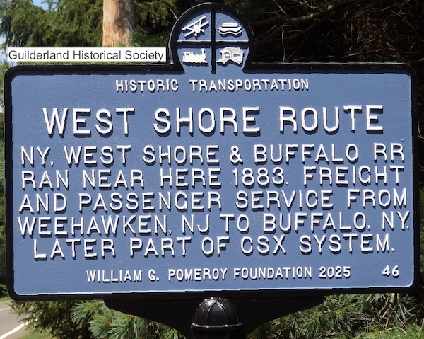 view the page in the Pomeroy Foundation website
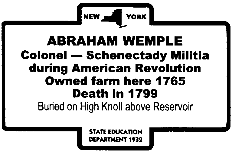
8) Abraham Wemple. Marker obtained in 1954
from the New York State marker program. South side of US Rte 20, 150
ft west of the Clover Pond Vineyard entrance.
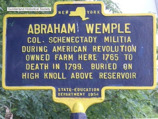
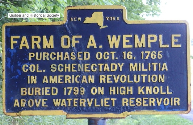
8a) Farm of A. Wemple. Older
marker, damaged and rewelded with lower part missing, located about
100 meters west of the other one; ?reinstalled recently.
 not included in Begley publication
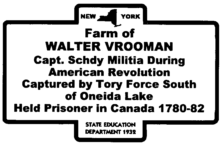
9) Farm of Walter Vrooman.
This marker was missing when Begley wrote her descriptions, and
remains lost. Location was south of the Normanskill bridge on State
Route 158, east side of the road.
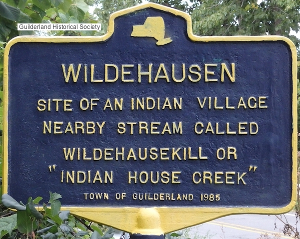
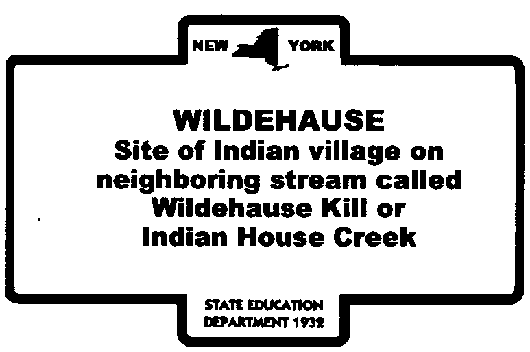
10) Wildehausen. W side of
Dunnsville Road, N of US Rte 20 crossroads. Replacement (of original
Wildehause marker) by the Town of Guilderland 1985.
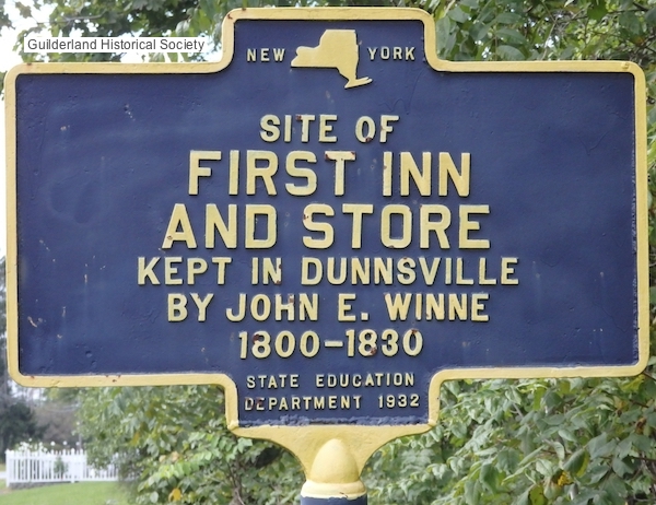
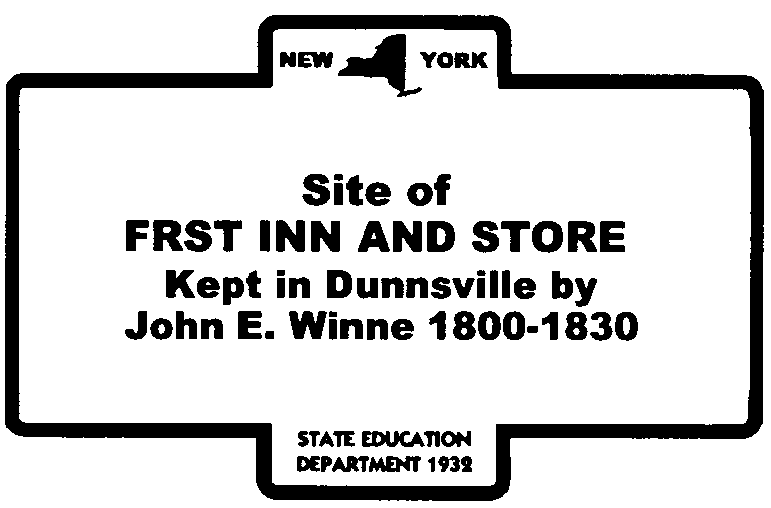
11) First Inn and Store (site
of). US Rte 20 in Dunnsville, just W of crossroads with traffic
light, N side. Original marker from New York state program 1932.
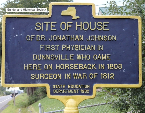
12) Dr. Jonathan Johnson
(house site). US Rte 20 in Dunnsville, W of crossroads with traffic
light, N side. Original marker from New York state program 1932.

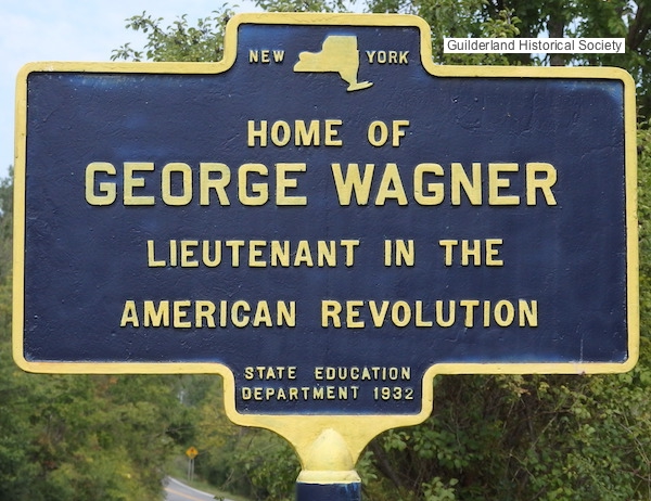
13) George Wagner (home).
Dunnsville Road (NY 397) E side, 0.3 miles S of US Rte 20
crossroads. Original marker from New York state program 1932.
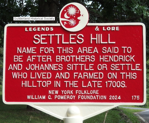
F) Settles Hill. N side
Settles Hill Road, 0.6 miles W of junction of Lainhart Road.
Obtained by New York Folklore with grant funding provided by the William G Pomeroy Foundation and installed in
2024.
 view the page in the Pomeroy Foundation website
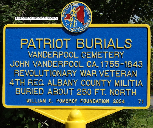
G) Patriot Burials - Vanderpool
Cemetery. N side Settles Hill Road, 0.7 miles W
of junction of Lainhart Road. Obtained by Empire State Society Sons
of the American Revolution with grant funding provided by the William G Pomeroy Foundation and installed in
2024.
 view the page in the Pomeroy Foundation website
----------------------------------------------------------
at this point, the markers on and near US Rte 20 in Guilderland are
completed. The Begley list continues by returning east along US Rte
20 to the NY Rte 149 intersection at Hartmans Corners, and then
resuming with markers along Rte 149, through Guilderland Center and
on to Altamont. As an alternative, marker enthusiasts could continue
up Settles Hill Road and turn south onto Westfall Road, going past
the Westfall Cemetery and the Van Auken Brothers markers, then to
the John Groot marker and those in and near Altamont, and return
east along NY Rte 149, mostly reversing the order of those listed
below.
----------------------------------------------------------
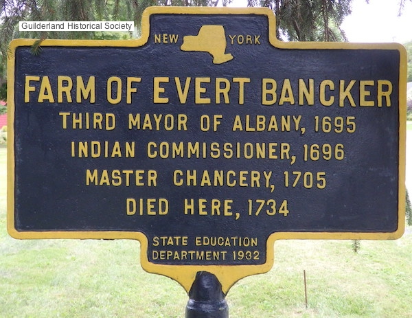
14) Farm of Evert Bancker. NY
Rte 146 about 0.4 mi south of junction with US Rte 20, W side.
Original marker from New York state program 1932.
17) Vale of Tawasentha. NY Rte
146 at the south end of the bridge over the Normanskill, E side.
Replacement marker by the Town of Guilderland 1997. The marker
illustration in Begley's booklet appears to be an editorial
oversight, omitting the substantive text. This marker has been
temporarily removed until the reconstruction of the bridge is
completed.
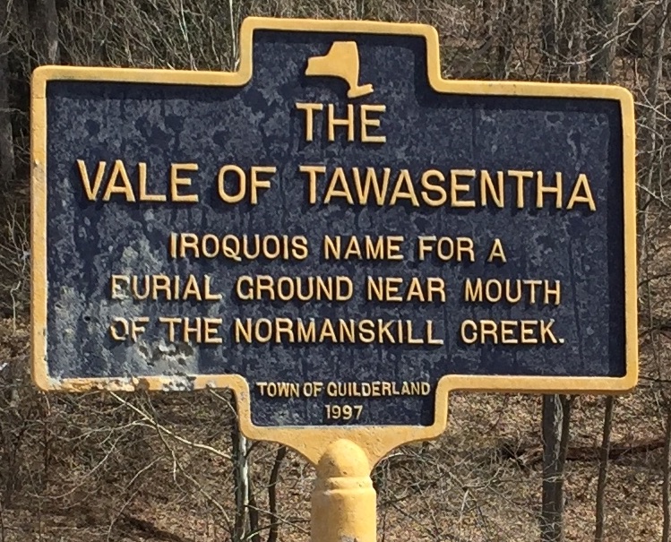
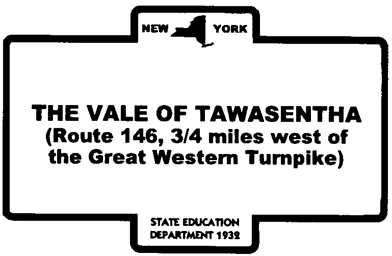
Image by Steve Stoessel HMdb.org
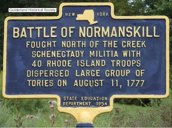
15) Battle of Normanskill. NY
146 N side about 0.25 mi W of the bridge over the Normanskill.
Original marker from New York state program 1954.
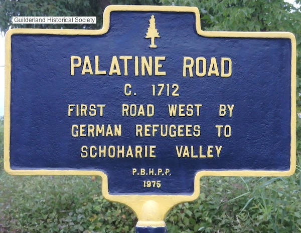
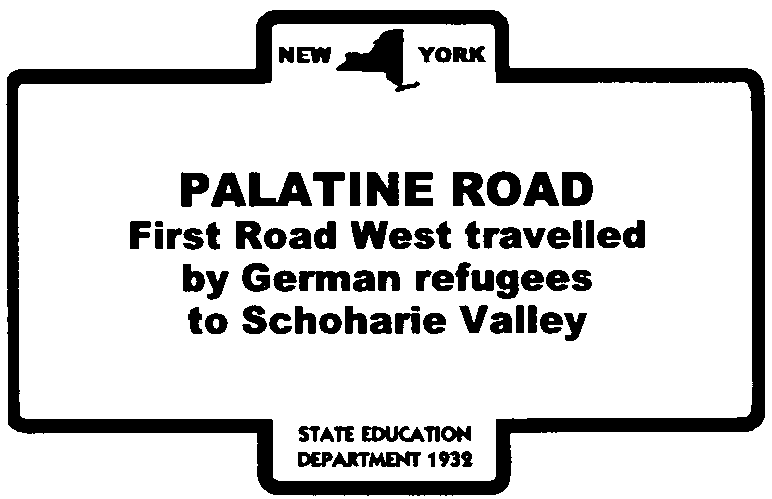
18) Palatine Road. NY 146 (S
side), just east of the bridge over the railroad. This marker was
originated by the Pine Bush Historic Preservation Project (the
P.B.H.P.P on the marker) and installed in 1975. The illustration in
Begley's booklet should not be taken to mean that there was an older
marker here.
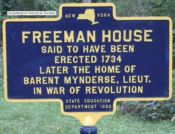
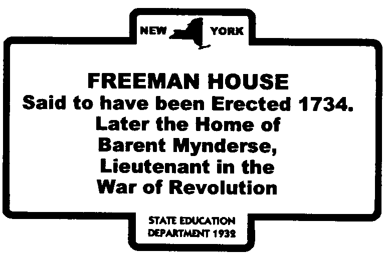
19) Freeman House. NY Rte 146
(N side) at the road bend in Guilderland Center, 200 ft W of the
French's Mill Road intersection.
Original marker from New York state program 1932.
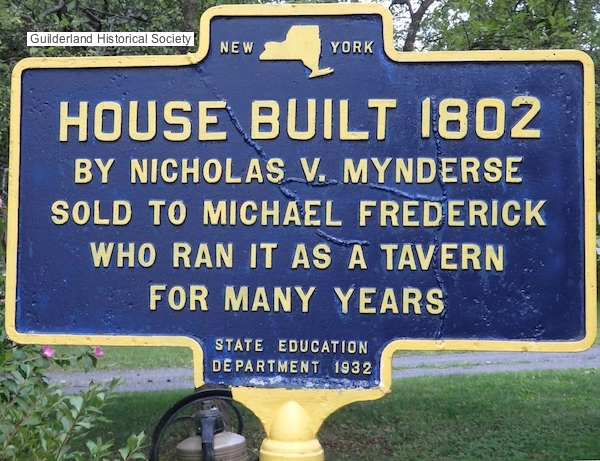
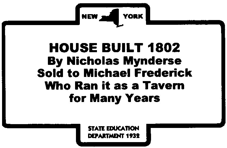
20) Mynderse-Frederick House. NY Rte 146 (N
side) in Guilderland Center just east of the crossroads with the
traffic light.
Original marker from New York state program 1932.
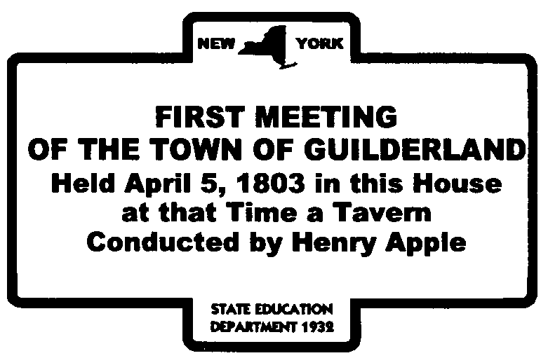
21) First Meeting of the Town of Guilderland
- Appel Tavern. NY Rte 146 (S side) west of Guilderland
Center. Original marker from New York state program 1932.

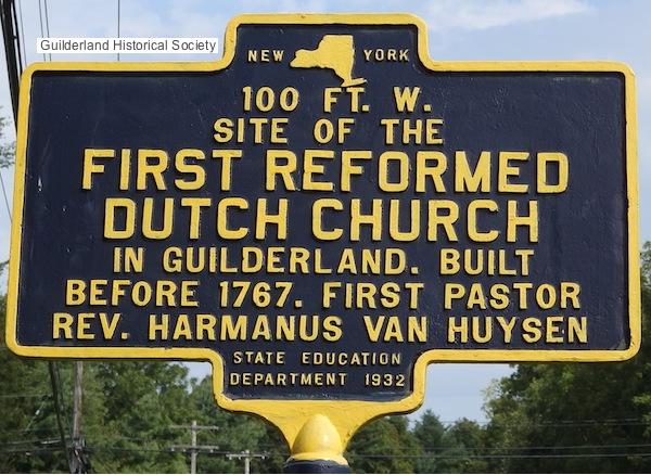
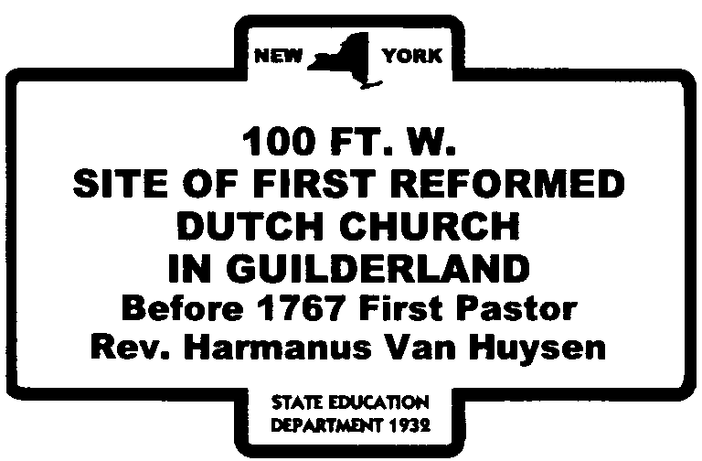
22) First Reformed Dutch Church in
Guilderland (site of). Rte 146 (N side) at the
intersection with NY Rte 158. Original marker from New York state
program 1932.
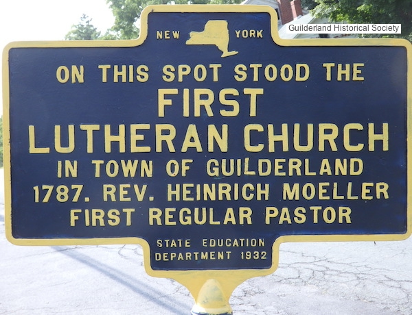
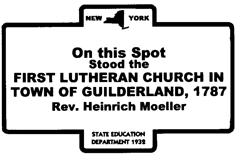
23) First Lutheran Church in Town of
Guilderland (site of). Rte 146 (E side) at
intersection with Hawes Road near top of hill. Original marker from
New York state program 1932.
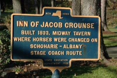
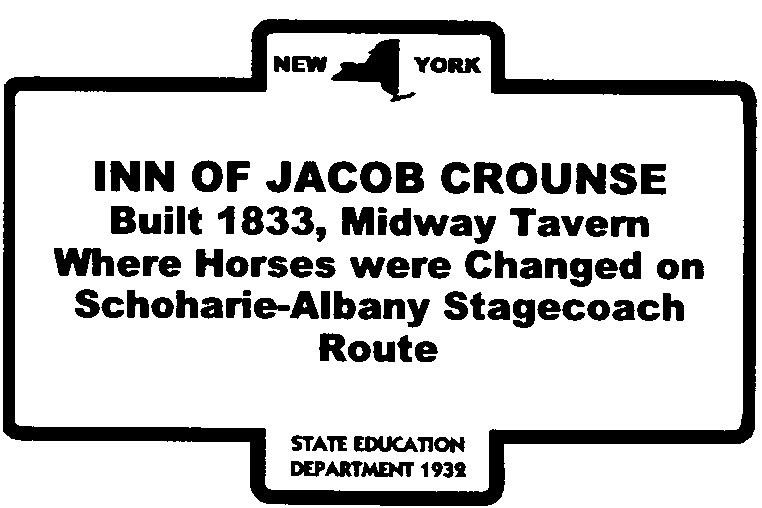
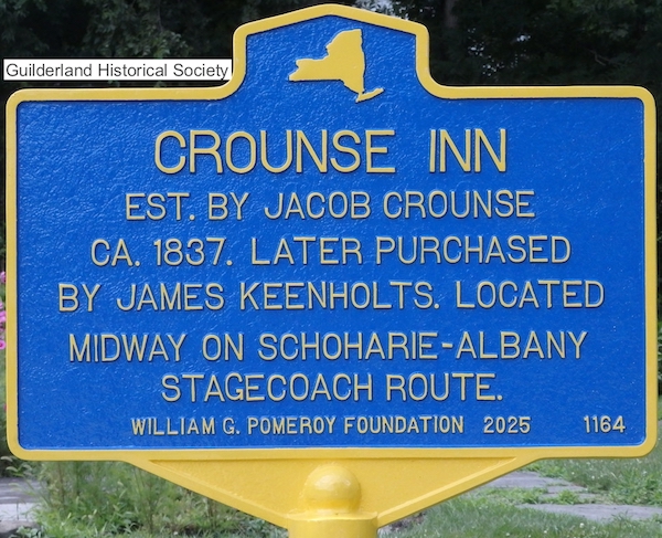
24) Inn of Jacob Crounse. Rte
146 (W side) in east part of Village of Altamont. Original marker
from New York state program 1932. Destroyed by inebriated driver in
2024; replaced in 2025 with new marker obtained by the Guilderland
Historical Society with grant funding provided by the William G Pomeroy Foundation.
 Pomeroy Foundation website page
Image by Howard C. Ohlhous HMdb.org
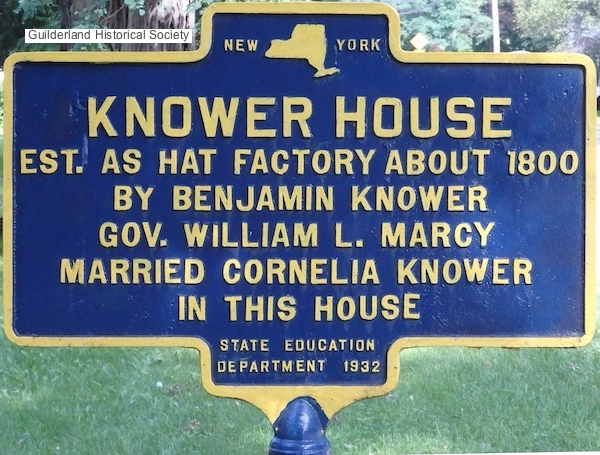
25) Knower House. Rte 146 (W
side) in east part of Village of Altamont. Original marker from New
York state program 1932.
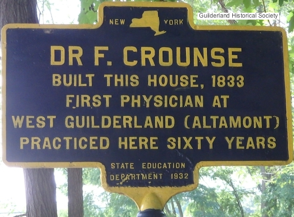
26) Dr. F. Crounse (site of
house). Rte 146 (W side) at junction with Gun Club Road. Original
marker from New York state program 1932.
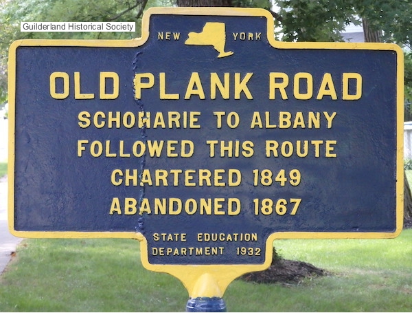
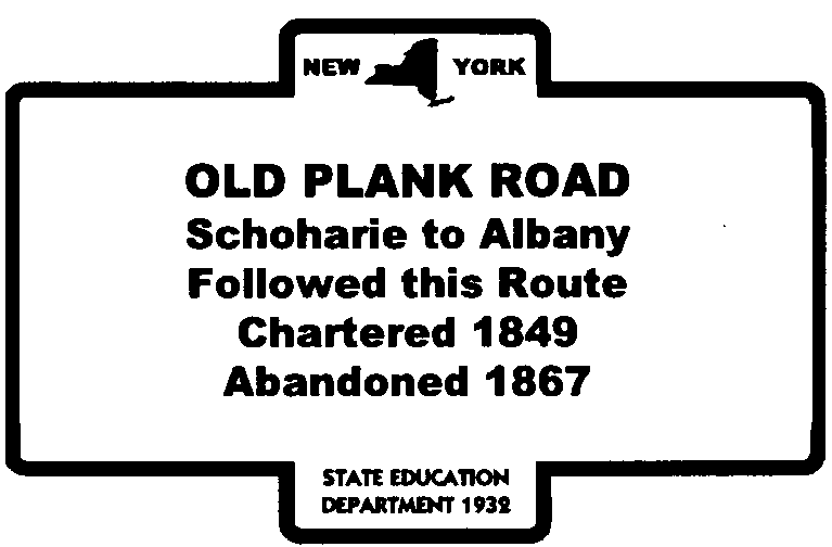
27) Old Plank Road (Schoharie
Turnpike). Rte 146 (W side) at junction with Schoharie Plank Road.
Original marker from New York state program 1932.
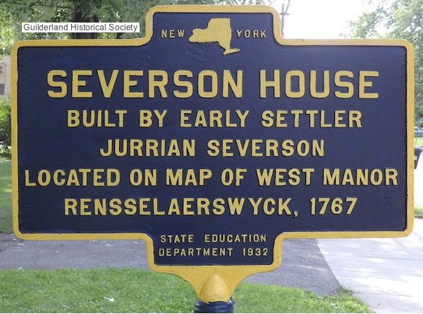
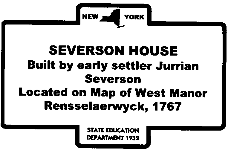
28) Severson House. Rte 146 (S
side) near Brandle Rd junction in Altamont. Original marker from New
York state program 1932.
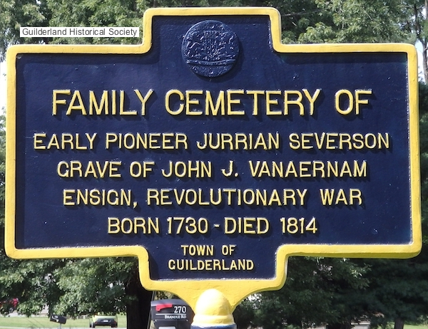
H) Family Cemetery (Severson).
E side Brandle Road, 0.1 mile from intersection with Main Street, NY
Rte 146. Marker installed by the Town of Guilderland (?1985); not
included in Alice Begley's booklet.
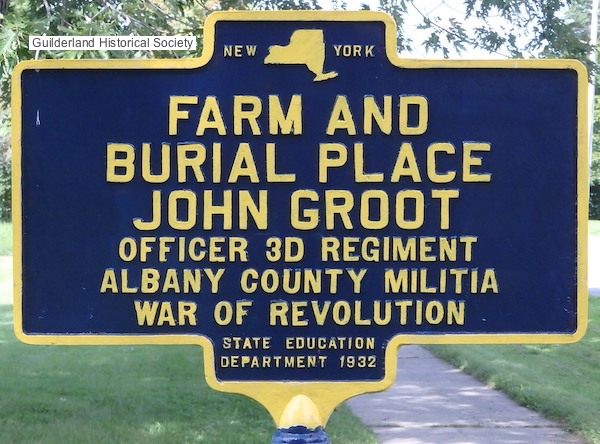
29) Farm of John Groot.
Dunnsville Road (NY Rte 397) W side in N part of Altamont
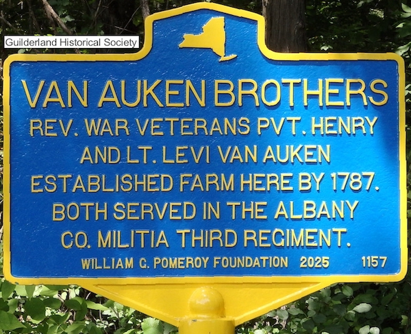
M) Van Auken Brothers. New
marker obtained by the Guilderland Historical Society with grant
funding provided by the William G Pomeroy Foundation and installed in
2025.
Located just off Westfall Road, on the north side of the parking
area for the Bozen Kill Preserve; entrance about 150 yards north of
the bridge over the Bozen Kill.
 view the page in the Pomeroy Foundation website
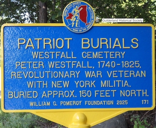
O) Patriot Burials - Westfall Cemetery.
E side Westfall Road, 0.6 miles N of junction at Bozenkill Road.
Obtained by Empire State Society Sons of the American Revolution
with grant funding provided by the William G Pomeroy Foundation and installed in
2025.
 view
the page in the Pomeroy Foundation website
view
the page in the Pomeroy Foundation website
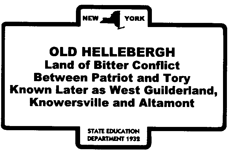
30) Old Hellebergh.
Replacement marker installed in 2025 by the Village of Altamont in
the SE corner of Orsini Park.
Original marker that was sited at corner of Main Street and Maple
Avenue had been missing since before 1994.
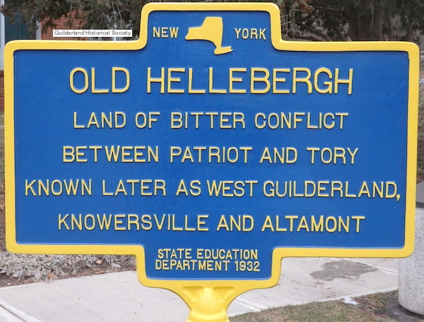
 informative Altamont Enterprise article
31) Altamont. Marker is a
replacement, and in a dfferent site from the original. Main Street
Altamont (SE side) near Park St intersection.
J) Delaware & Hudson R.R.
Sponsored by the Guilderland Historical Society and funded by a
grant from the William G Pomeroy Foundation. Installed in
2024 at the Altamont Library (the former Altamont railroad station).
 view the page in the Pomeroy Foundation website
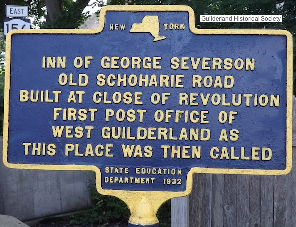
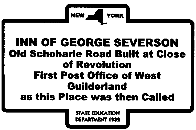
32) Inn of George Severson.
Altamont Bvld (Rte 156) S side about 50 meters from the Main St
intersection. Original marker from New York state program 1932.
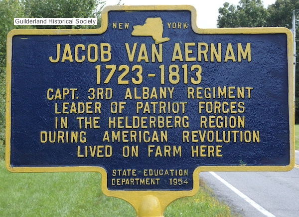
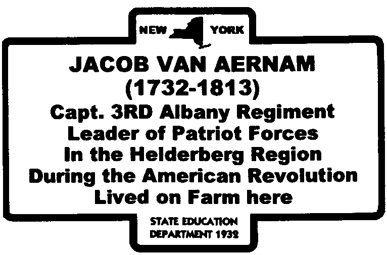
33) Jacob Van Aernam. Rte 156
about ¾ mile east of Altamont, N side. Original marker from New York
state program 1954.
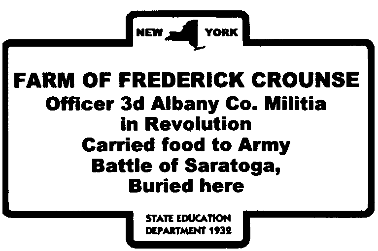
34) Farm of Frederick Crounse.
Rte 156 about 1 mile east of Altamont, S side. Original marker from
New York state program 1932.

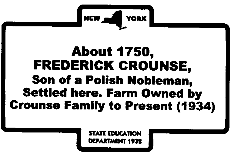
35) Frederick Crounse. Rte 156
about 1 mile east of Altamont. Marker is missing.
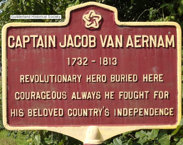
K) Captain Jacob Van Aernam.
Brandle Road, east side, 0.6 mile N of intersection with NY Rte 156,
just before the railroad crossing.
A Bicentennial marker, installed 1976. Begley's booklet does not
include this one.
McKownville Improvement Association - Local History
Guilderland
Historian
Guilderland
Historical Society
Draft version of 2025-12-28 prepared by WK